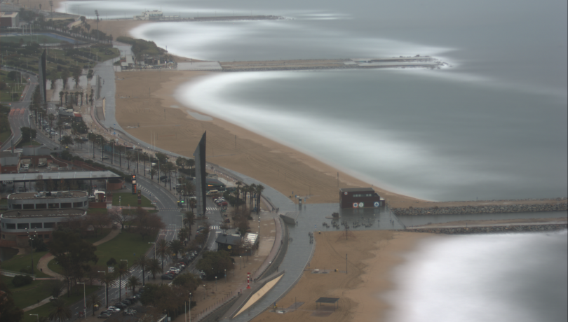
According to the experts, the intensity of the regression is related to the artificiality of the beaches, their morphology, the waves and the structures of protection.

The Institut de Ciències del Mar (ICM) in Barcelona has quantified the erosion of the city's beaches over the last two decades. According to the experts, this is due to their artificiality, morphology, waves, the effect of storms, and the construction of protective structures such as seawalls, which modify the natural distribution of sediment on the beaches.
"Barcelona's beaches hardly receive any natural sediment inputs and the loss of sediment caused by the effect of waves, especially during storms, can only be compensated by dumping sand brought from elsewhere, which has led to their progressive regression", explains ICM researcher Jorge Guillén.
Twenty years monitoring the coast
This diagnosis has been possible thanks to the exhaustive monitoring carried out by the Institute's Coastal Observatory, which is now celebrating its 20th anniversary. During all these years, images of Barcelona’s beaches have been taken every hour, which has allowed to deepen the knowledge of the sedimentary dynamics and evaluate the impact of artificial sand regeneration and other anthropic actions.
"The analysis of all the images has led to a considerable improvement in our knowledge of the behaviour of embedded urban beaches -that is, those that are limited by breakwaters- and has allowed us to extract tools to improve their management, as Barcelona's beaches can be considered, because of their size, a natural laboratory for scientific research, as well as one of the city's emblems", explains ICM researcher Ruth Durán, who is a member of the Observatory.
For his part, Òscar Chic, also a member of the Observatory, assures that "during these years we have generated a unique, high-quality database for the study of coastal morphodynamics, which will also serve future generations of scientists to tackle different subjects that we can't even imagine now".
Evolution of the coastline
Thanks to the images from the ICM's Coastal Observatory, researchers can find out the emerged beach surface, the rotation of the coastline -due to the angle of approach of the waves-, the erosion caused by storms or the increase in surfaces after artificial regeneration, among others. All these data are also used for verifying models of shoreline evolution and for assessing the effects of climate change in the mid-term.
"This is especially relevant at a time when the rise in sea level due to global warming and the increasing recurrence and intensity of storms threaten to jeopardise the future of our beaches", states Gonzalo Simarro, another member of the Observatory.
In this sense, Simarro adds that "these impacts have already begun to be perceived in Barcelona, although they are not dominant, and will be aggravated by the limited width of the beaches, by their limited capacity for adaptation due to their urban component and by the absence of natural sedimentary contributions".
Agreement with the administration
Given this scenario, since 2015 the Observatory information has been transferred to Barcelona City Council to improve the management of the city's beaches. In addition, a group of experts has been created, including members of the ICM Coastal Observatory.
Its task is to discuss aspects such as the change of use of beaches, the progressive adaptation to new conditions, or the use of nature-based techniques –such as the extension of the inner areas of beaches- as preventive systems to develop adaptation strategies and thus ensure the future of the city's beaches.